
Despite its relatively small size, Ecuador has an INCREDIBLY diverse landscape! Within its boundaries are four distinct natural geographic zones:
(As someone who majored in environmental science... this is pretty exciting~!)
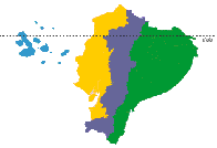
- The Andes (violet)
- The Amazon (green)
- The Coast (yellow)
- The Galapagos Islands (blue)
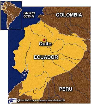
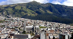
Quito, the Nation's capital city, is located in the Andes at an altitude of over 9,000 feet and is surrounded by towering mountains and volcanoes!
The Equator lies approximately 18 miles to the north of Quito. I'm sure I will be visiting the site of the "center of the world" during my stay in the country.
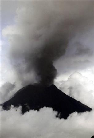 About 80 miles to the south of the city, the Tungurahua Volcano has erupted several times this summer and .... just erupted again the 17th of August! The agricultural villages at the base of the volcano were evacuated; hundreds of acres of crops were covered in ash. Predictions of further volcanic activity include a possible larger eruption from the Tungurahua volcano sometime within the next year.
Stay tuned, as this is only the pinpoint beginning for this blog...

No comments:
Post a Comment